skip navigation
This website is no longer being updated and may include outdated content and broken links.
Information on solar energy development on public lands is available through the BLM's Solar Energy Permitting and Program Resources website.
  2012 Solar Energy Development Programmatic EIS  
secondary menu
News Frequently Asked Questions Glossary E-mail Services


Solar PEIS SEZs

Frequently Asked Questions

Imperial East Panoramic Photos

Click a photo icon on the map to view panoramic photographs of the solar energy zone. You may also right-click to save the photo to your computer. Note: Some distortion occurs in all photos, and other anomalies from photo processing are visible in some images.

Imperial East SEZ
(does not show non-development areas)
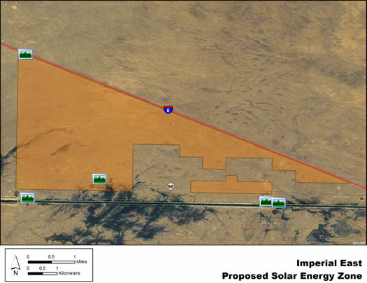
Imperial East Drop 3 Drop 3 Levee US 98 Drop 4 NW Corner