Los Mogotes East
Maps
| Colorado Variance Areas |
Los Mogotes East SEZ |
 |
 |
|
|
|
SEZ Analysis
The Los Mogotes East solar energy zone (SEZ) is located in Colorado in a high-elevation basin within the Rocky Mountains. The SEZ is located on BLM-administered land within the La Jara Field Office.
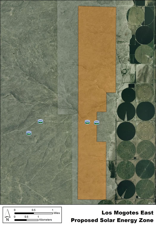
Size and Location
In the Draft Solar PEIS, the proposed Los Mogotes East SEZ had a total area of 5,918 acres (24 km2). In the Supplement to the Draft, 3,268 acres (13.2 km2) on the western side of the SEZ were eliminated to avoid impacts on several resources, including impacts on sensitive species. No additional changes to the SEZ developable areas were made in the Final Solar PEIS.
The Los Mogotes East SEZ is located in Conejos County in south-central Colorado, about 12 mi (19 km) north of the New Mexico border. The SEZ is located in the southwestern San Luis Valley, part of the San Luis Basin, a large, high-elevation basin. The San Juan Mountains are to the west and the Sangre de Cristo Range is to the east. In 2008, the county population was 8,745, while the surrounding four-county region had a total population of 39,759. The largest nearby town of Alamosa is located about 22 mi (35 km) to the northeast.
Los Mogotes East SEZ
(Non-development areas have not been identified within the SEZ.)
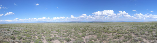
Physical Characteristics
The Los Mogotes SEZ lies on a flat alluvial fan. Scrubland vegetation reflects the arid climate. Vegetation is primarily low shrubs and grasses, with many areas of bare soil. Large groundwater reserves underlie the area in several aquifers. Annual rainfall averages about 8 in. (20 cm).
No developments exist on the land. Part of the SEZ is authorized by the BLM for grazing. There are a few unpaved roads, fences, and some debris on the SEZ.
Little commercial or industrial activity exists in the surrounding area. An extensive agricultural area lies to the east.
Technical Suitability
U.S. 285 is located about 3 mi (5 km) east of the SEZ. An existing 69-kV transmission line is also located about 3 mi (5 km) to the east of the SEZ. As of May 2012, there were no pending solar project applications within the SEZ.
|