Gillespie
Maps
| Arizona Variance Areas |
Gillespie SEZ |
 |
 |
|
|
|
SEZ Analysis
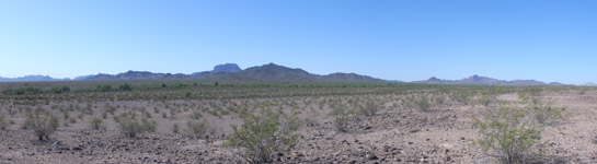
The Gillespie solar energy zone (SEZ) is located in Arizona in a semiarid basin with undeveloped scrubland. The SEZ is located on BLM-administered land within the Lower Sonoran Field Office.
Size and Location
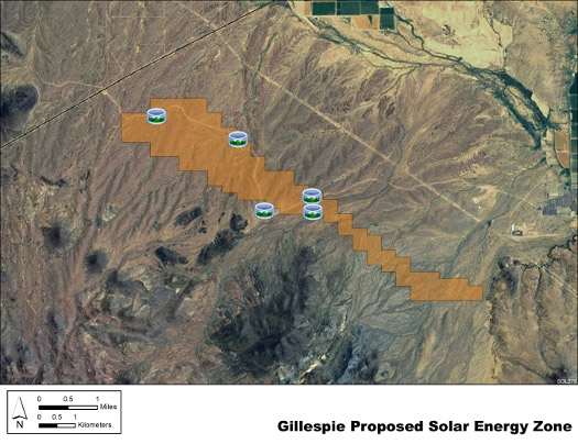
The Gillespie SEZ has a total area of 2,618 acres (11 km2). No changes were made to the boundaries of the Gillespie SEZ in the Supplement to the Draft Solar PEIS or the Final Solar PEIS, and no non-development areas were identified within the SEZ.
The Gillespie SEZ is located in Maricopa County in west-central Arizona. The SEZ is located to the southeast of the Harquahala Basin, in a valley between Gila Bend Mountains to the southwest and Centennial Wash to the northeast. In 2008, the county population was 3,958,263. The nearest town of Arlington is located about 7 mi (11 km) northeast of the SEZ.
Gillespie SEZ
(Non-development areas have not been identified within the SEZ.)
Physical Characteristics
Land within the Gillespie SEZ is undeveloped scrubland characteristic of a semiarid desert valley. Vegetation within the SEZ is predominantly creosotebush and other low shrubs, with areas of dark, volcanic rock. Several intermittent washes run through the SEZ in a southwest to northeast direction. Annual rainfall is less than 8 in. (20 cm).
The SEZ is undeveloped and rural, and contains a graded, county gravel road and other unpaved roads, and fencing. Part of the SEZ is authorized by the BLM for grazing.
The Palo Verde nuclear power plant, three natural gas power plants, a railroad, transmission lines, and a pipeline right-of-way are located in the surrounding area, which has few permanent residences.
Technical Suitability
The nearest major road access to the SEZ is via Old U.S. 80, which runs north-south 3 mi (5 km) from the eastern tip of the Gillespie SEZ. A 500-kV transmission line runs less than 1 mi (1.6 km) west of the SEZ. There were no pending solar project applications within the SEZ as of May 2012.
|