Brenda
Maps
| Arizona Variance Areas |
Brenda SEZ |
 |
 |
|
|
|
SEZ Analysis
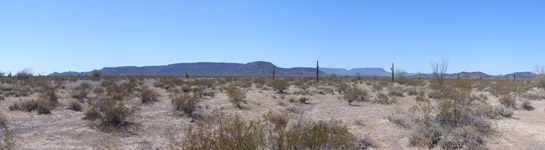
The Brenda solar energy zone (SEZ) is located in Arizona in a semiarid basin with undeveloped scrubland. The SEZ is located on BLM-administered land within the Lake Havasu Field Office.
Size and Location
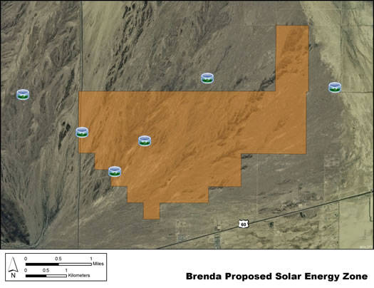
The Brenda SEZ as proposed in the Draft Solar PEIS had a total area of 3,878 acres (15.7 km2). In the Supplement to the Draft Solar PEIS, 31 acres (0.13 km2) of the Bouse Wash in the northeastern portion of the SEZ were identified as a non-development area, leaving the SEZ with a potentially developable area of 3,865 acres (15.6 km2). In the Final Solar PEIS, the boundaries of the proposed Brenda SEZ were reduced, eliminating the area of Bouse Wash on the east side of the SEZ and eliminating the area on the west side of the SEZ to the west of the county road (a total of 530 acres [2.1 km2]. The final potentially developable area of the SEZ as identified in the Solar PEIS ROD is 3,348 acres [13.5 km2])
The Brenda SEZ is located in La Paz County in west-central Arizona, 32 mi (52 km) east of the California border. The SEZ is located on Ranegras Plain, bounded on the north by Bouse Hills, on the west–southwest by Plomosa Mountains and Bear Hills, and on the east by Granite Wash Mountains and Harquahala Mountains. In 2008, the county population of La Paz was 20,005, while adjacent Riverside County to the west in California had a population of 2,087,917.
Brenda SEZ
(Non-development areas have not been identified within the SEZ.)
Physical Characteristics
Land within the SEZ is undeveloped scrubland characteristic of a semiarid basin. Vegetation is predominantly creosotebush and other low shrubs. The southwest portion of the SEZ is more densely vegetated with various trees and shrubs in addition to cacti. The intermittent Bouse Wash runs through the eastern portion of the SEZ. Annual rainfall averages 4 to 8 in. (10-20 cm).
The SEZ is undeveloped and rural, with few permanent residents in the area. Several unpaved roads cross the SEZ, and a corral and well are located on the western edge. Part of the SEZ is authorized by the BLM for grazing.
The surrounding area includes agricultural lands and associated structures, livestock corrals, and fences. U.S. 60, I-10, and several unpaved roads are located in the vicinity of the SEZ. Residential and other structures are located along U.S. 60.
Technical Suitability
The nearest major road access is via U.S. 60, which runs along the southeast border of the Brenda SEZ. For the Brenda SEZ, the nearest existing transmission line is a 500-kV east–west line located about 12 mi (19 km) south of the SEZ, and there is a designated transmission corridor adjacent to the southern SEZ boundary. As of May 2012 there were no pending solar project applications within the SEZ, but there were several pending applications for solar projects that would be located within about a 25-mile (40-km) radius of the SEZ.
|