|
|
|
|
|
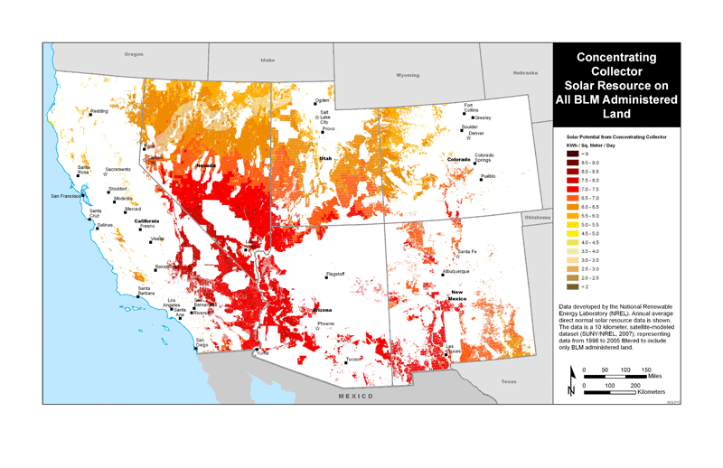
Solar Resource Data and MapsThe NSRDB Viewer, an interactive application sharing spatial data for solar energy resources across the United States, and maps showing solar energy resources on BLM-administered lands in the study area of the Solar PEIS. NSRDB ViewerThe National Renewable Energy Laboratory (NREL) has developed an interactive mapping tool, called the National Solar Radiation Database (NSRDB) Viewer, that allows users to examine, distribute, and analyze solar resource data for the United States and northern Mexico. It assists in making decisions about optimal locations for CSP plants. Users can explore temporal and spatial aspects of NREL's solar resource data and can download the resource data for use outside of the tool. Solar Resource MapsClick the images below to view maps of concentrating collector and tilted photovoltaic panel solar energy resources on BLM-administered lands in the six-state PEIS study area. These maps are based on data provided by the NREL, in the convenient Adobe Acrobat format.
|


